A contractor on a commercial build near the American River Parkway called us last spring after excavating 18 feet for an underground parking structure. The cut face looked fine at first, but within 48 hours tension cracks began forming along the crest, migrating toward an existing stormwater retention basin. That rapid stress relief in Sacramento’s young alluvial deposits catches plenty of people off guard. The city sits at the confluence of the Sacramento and American Rivers, sitting on a deep sequence of Holocene silts, loose sands, and occasional peat lenses that behave nothing like the competent rock you find in the foothills 30 miles east. Our slope stability analysis combines Limit Equilibrium Methods with finite element modeling to quantify the factor of safety under both static and seismic conditions, so contractors and design engineers in Sacramento aren’t guessing when it comes to setback distances or temporary shoring requirements.
A factor of safety of 1.0 in a Sacramento levee isn’t a margin—it’s the onset of a failure mechanism that can mobilize hundreds of feet of embankment in minutes under rapid drawdown.
Scope of work in Sacramento
Risks and considerations in Sacramento
The field crew typically deploys a truck-mounted CPT rig with a 20-ton capacity cone and a seismic module, or a hollow-stem auger drill when we need undisturbed Shelby tube samples from a suspected weak layer at 25 feet. Sacramento’s summer heat—regularly exceeding 100°F in July and August—demands hydraulic systems that won’t overheat during a full-day push, and the fine-grained soils here can cake onto cone rods fast enough to throw off sleeve friction readings if the operator isn’t cleaning between pushes. Beyond equipment, the real risk is incomplete stratigraphy. A 2017 Caltrans report on I-5 corridor embankments near the Sacramento River noted that undetected paleochannel deposits with organic content above 5% contributed to long-term creep in several approach fills. If your investigation misses those buried channels, the analysis spits out a factor of safety that looks fine on paper but degrades over time as the organic material decomposes and compresses.
Our services
Our slope stability work in Sacramento covers the full chain from subsurface investigation through design recommendations and construction-phase monitoring.
Levee and Embankment Stability
Analysis of Sacramento River and American River levee sections under steady-state seepage and rapid drawdown, with deformation modeling for peat and organic soil layers common in the Delta region.
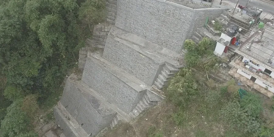
Temporary and Permanent Cut Slope Design
Stability evaluation for excavations deeper than 12 feet, including shoring design parameters and setback recommendations based on in-situ testing and laboratory-derived shear strength.
Seismic Slope Stability
Pseudo-static and Newmark displacement analysis for slopes within the Sacramento seismic design category, accounting for site-specific ground motion amplification through the deep alluvial basin.
Quick answers
What triggers a slope stability analysis to be required in Sacramento County?
The Sacramento County Building Division and the Central Valley Regional Water Quality Control Board generally require a slope stability analysis for any permanent cut or fill slope exceeding 10 vertical feet, any slope within 200 feet of a levee or waterway, and any excavation where adjacent structures or public right-of-way could be impacted. Projects near the American River Parkway or within the FEMA-designated floodway trigger additional review under the local floodplain management ordinance.
How much does a slope stability analysis cost for a typical Sacramento project?
For a standard commercial or residential hillside project in the Sacramento metro area, the analysis typically ranges from US$1,090 to US$4,710 depending on the number of cross-sections, the depth of the failure surface being investigated, and whether seismic deformation analysis is required in addition to static equilibrium checks.
Which failure modes are most critical in Sacramento’s soil profile?
Deep-seated rotational failures through soft clay lenses and translational block sliding along silt seams are the two modes we see most often in the Sacramento Formation. Rapid drawdown failures in levees and streambank slopes are equally critical—when the river stage drops quickly after a storm, the pore water trapped in the embankment can’t dissipate fast enough, reducing effective stress and triggering sloughing or full slope collapse.
How long does a slope stability investigation take from start to final report?
A typical investigation timeline runs three to five weeks. The first week covers field drilling or CPT soundings. Laboratory testing for shear strength parameters takes another two weeks, and the analysis and report preparation require one to two additional weeks. Projects requiring seasonal groundwater monitoring extend the schedule by several months to capture both wet and dry season conditions.
Does Sacramento’s seismic hazard affect slope stability requirements?
Yes, and it’s often underestimated. While Sacramento lies outside the highest shaking zones of the Bay Area faults, the deep sedimentary basin amplifies long-period ground motion, and loose saturated sands within the alluvial profile are susceptible to cyclic softening and liquefaction. Our seismic slope stability analyses incorporate site-specific acceleration response spectra and evaluate accumulated permanent displacement using the Newmark sliding block method. More info.